Smart Motorways: fatally flawed, but not beyond saving
December 31, 2025
Welcome to my blog! This is my launch article and it covers what smart motorways are, their troubling track record, short-term fixes, and, ultimately, how they can be improved to become what they were envisioned to be.
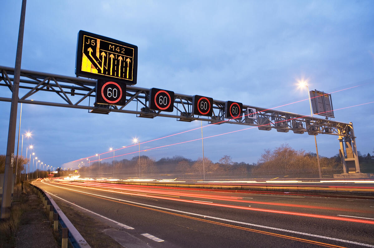
The M42 with its hard shoulder as an active lane
Smart motorways were designed to be the future of Britain’s road network. Instead of the DfT spending significant amounts of money on widening motorways, engineers could increase capacity whilst leveraging existing infrastructure through the use of technology. This would allow them to vary speed limits, manage congestion, and even open the hard shoulder during periods of heavy traffic. They currently make up 10% of the strategic road network. The principle was sound: squeezing as much capacity out of existing carriageways as possible.
Yet after almost twenty years of operation, smart motorways are seen as dangerous by the public. High-profile accidents, delayed safety measures, and patchy technology have left drivers questioning whether the risks are worth it, causing the DfT to cancel all planned smart motorway conversions (not under construction) in 2023.
The concept
Smart Motorways use technology to improve throughput without widening, using dynamic speed management and flexible carriageway use instead.
Dynamic speed management
Overhead gantries display variable speed limits between 40 and 60mph, reverting to 70mph when no restriction applies. Matrix signs warn of incidents, delays, and road conditions ahead. In theory it was quite elegant: slowing traffic before congestion forms maintains flow and prevents the stop-start driving that causes secondary collisions.
Flexible carriageway use
Rather than building new lanes, smart motorways repurpose the hard shoulder. Dynamic hard shoulder (DHS) sections open it during congestion. With all-lane running (ALR) schemes it’s permanently converted into a traffic lane.
In place of a permanent hard shoulder, emergency refuge areas (ERAs) appear at intervals along the motorway. These are wider than traditional hard shoulders, set back from traffic, and protected by barriers.
The M42 (J3a–7) pilot proved it worked. Speed management started in 2005 and DHS was enabled in 2006. With close ERA spacing and careful monitoring, the DHS scheme delivered journey time reliability without compromising safety.
Infrastructure stack
To achieve dynamic speed management and flexible carriageway use, several interconnected systems are deployed.
Stopped Vehicle Detection (SVD): Radar-based sensors designed to identify stationary vehicles within seconds, automatically alerting control room operators to close affected lanes. This is the safety net when drivers can’t reach an ERA.
Motorway Incident Detection and Automatic Signalling (MIDAS): Induction loops embedded beneath the carriageway monitor traffic speed and flow in real-time. When speeds drop or density increases, MIDAS feeds data to operators, who adjust variable speed limits accordingly.
CCTV and control rooms: Pan-Tilt-Zoom (PTZ) cameras provide visual confirmation of incidents. Regional Operations centres (ROCs) monitor these feeds, manually setting Red X lane closures and variable speed limits based on observed conditions.
NTIS (National Traffic Information Service): The data aggregation layer. Traffic flow, incidents, and speed limits from across the network feed into NTIS, which pushes updates to navigation apps and provides journey time estimates.
This technology stack was meant to create a responsive, self-monitoring network where incidents trigger rapid responses and congestion gets smoothed before it compounds. Sensors detect problems, operators verify and respond, drivers receive accurate information, and traffic flows optimally even at maximum capacity.
So why did the DfT cancel all* planned conversions in 2023?
The implementation: shortcomings
The infrastructure and operations of Smart Motorways have lead to shortcomings compared to the concept, making accidents more fatal when they do happen.
Infrastructure
Problematic Stopped Vehicle Detection
SVD is arguably the most important technology for smart motorways to function. With ALR becoming the preferred deployment, this technology needed to be accurate, reliable, and operational from day one.
When Highways England (now National Highways) appeared before the Transport Select Committee in 2016, the Chief Highway Engineer assured MPs that SVD “works” and would be “part of the standard roll-out of smart motorways going forward”, setting expectations that new ALR schemes would include SVD as a baseline (with older sections upgraded).
In reality, SVD didn’t become standard until 2018, two years late. By 2019, only 18% of ALR motorways had it installed. The end result was years of ALR running with the single most important safety layer missing.
Without SVD, control room operators relied on CCTV and indirect indicators to spot stopped vehicles. Highways England’s own evidence suggested it could take around 17 minutes on average to identify a stranded vehicle and initiate protection, leaving broken-down drivers exposed in live lanes with no warning for approaching traffic.
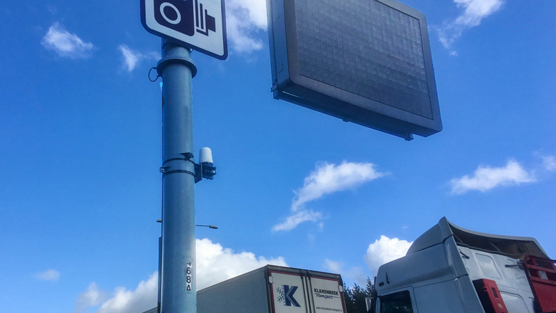
Radar-based SVD sensor
To be clear: modern radar-based SVD (installed on all ALR sections since September 2022) can be fast. ORR’s latest assessment (based on National Highways’ annual “performance monitoring and reporting” process) shows that, across the schemes tested in 2024, national-level performance met the company’s targets: detection rate 86% (target >80%), false discovery rate 6% (target <15%), and average alert time 12.9 seconds. It also reports that 91% of detected stopped vehicles were detected within 20 seconds.
However, Annex B from the report shows that performance was not consistent across schemes. Of the 12 schemes reported on:
- 4 didn’t meet detection targets, with the lowest at 69%
- 1 had an excessive false discovery rate of 19%
- 2 took longer than 20 seconds on average to detect vehicles
So more than half of the schemes failed on one metric.
There’s another catch: a large share of SVD’s performance data is unverified as the CCTV footage used in monitoring is often insufficient (cameras pointing the wrong way, poor coverage/visibility, missing start/end times). Annex C shows that in 2024, 62% of SVD alerts (1,352 out of 2,180) were classed as unverified. That doesn’t mean SVD didn’t work. It means the system is operating with limited observability in the very process used to prove it works.
And even if the radar layer performs well, it still depends on the rest of the end-to-end stack being up. ORR’s outage case studies include periods where SVD and other operational technology were affected together (such as a power outage on the M5 J6 affecting SVD, MIDAS, CCTV, signs and signals, and a planned national system outage affecting CCTV and SVD).
So yes: SVD is fast when it’s present and the chain is intact. But the rollout was 6 years late, and the evidence base shows the wider system still has blind spots: in monitoring, in supporting CCTV, and during outages. In ALR, those blind spots are exactly where the risk lives.
Inconsistent refuge area spacing
With a patchy detection system, surely accessing an emergency refuge area wouldn’t be difficult?
The M42 pilot had ERAs spaced at 500-800m apart, with the hard shoulder only opened at peak times. This close spacing was deemed essential for safety and contributed to the pilot’s success. The AA President noted it “worked quite well”.
Despite this evidence, spacing was changed to 2.5km, becoming the ALR standard from 2013 onwards, a decision that was eventually reversed. The consequences were predictable: AA research found 32% of drivers would only drive 400m to reach an ERA before stopping in a live lane, with a further 23% willing to travel just 800m. Only 42% of drivers who broke down actually reached an ERA. The majority were left stranded in live traffic.
Following safety concerns, Highways England trialled improvements on the M3 (J2–4a) in July 2017: bright orange surfacing, clearer SOS signage, and distance countdown markers. Though ERA spacing remained at 2.5km, the trial was successful and has been rolled out network-wide.
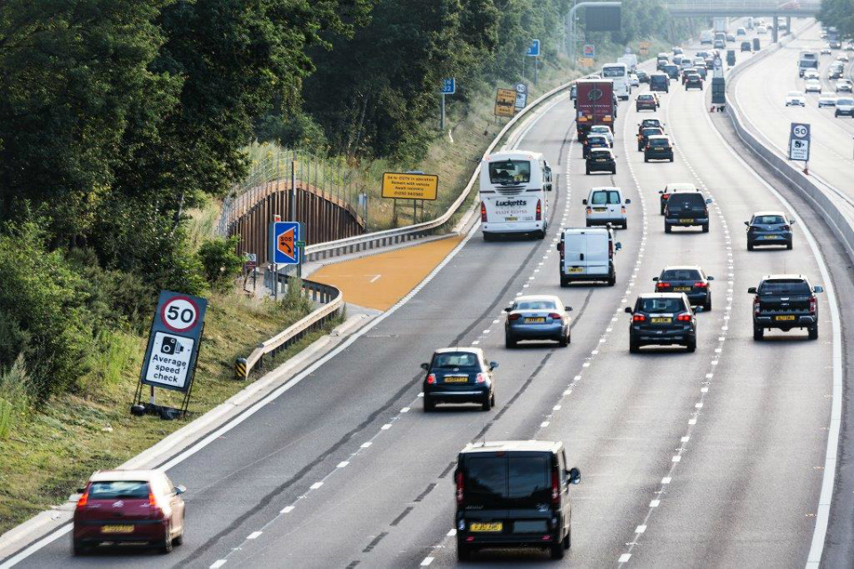
An enhanced ERA being installed on the M3
In March 2020, Transport Secretary Grant Shapps admitted ERAs “were spaced way too far apart” and committed to maximum 1.6km spacing, with 1.2km where feasible. A £390m programme to retrofit 150+ additional ERAs to existing ALR motorways was completed by April 2025. National Highways maintains that ERAs are safer than hard shoulders. They’re usually wider, set back from traffic and protected by barriers. But this is misleading: they’re only safer if reachable.
With ERAs at 1.5km spacing, a driver could be 750m from the nearest refuge. At 70mph, just 24 seconds of warning before mechanical failure, assuming the driver knows an ERA is coming and their vehicle cooperates. With a continuous hard shoulder, reaching safety requires no advance warning. Even if a driver reaches an ERA, they still depend on control room operators spotting them to close the lane, a process that, without SVD, took an average of 17 minutes.
Operations
Scaling infrastructure without operations
Smart infrastructure requires smart resourcing; instead, the network expanded far faster than the people managing it.
“The number of staff in the [control] room has always been woefully low”, an unidentified former control room operative admitted. Andrew Morgan, former control room operator, testified to the Transport Select Committee that the East Midlands Control Room had almost identical staffing levels in 2008 and 2021, despite significant workload increases from ALR schemes, describing the safety of the roads as “questionable”. During peak pressure, the workload became “unbearable, things can get missed”. National Highways claimed a 22% increase in operators (308 to 382), but this hasn’t kept pace with network expansion.
The control rooms are chronically understaffed. What about the technology they’re using?
In March 2020, BBC SouthEast reported Highways England admitted not all CCTV screens could be observed at all times. The agency refused to confirm or deny this, but the technical reality supports it: PTZ cameras can only look in one direction, requiring manual operation. With CCTV coverage and density expanding rapidly compared to control room staff, continuous monitoring across hundreds of miles becomes physically impossible.
Equipment reliability compounded the problem. Morgan testified that two M6 Matrix signals remained faulty for two years after he identified them. CCTV quality was “often unacceptable”: foggy lenses, poor positioning, faulty cameras even in early weeks of new ALR sections. Maintenance was “at best inconsistent”. FoI requests revealed ongoing CCTV service outages on M25 sections, with fault logs showing communication link failures between cameras and ROCs.
Red X enforcement and neglect
Even when technology worked, closing lanes introduced delays. Control rooms must manually verify and set Red X signs, with no direct communication line for recovery operators and no mandated response times. Recovery operators report difficulties getting protection, whilst emergency services report similar delays.
But even set Red X signs only work if drivers obey them. Legislation enabled camera-based prosecution in June 2019, but enforcement didn’t begin until 2021, two years later. Only half of HADECS 3 cameras, used in enforcement, were operational then. The full upgrade was not completed until September 2022, 3 years after the law changed. Between 2021-2023, over 53,000 motorists were caught ignoring Red X signs. National Highways claims “above 90% of drivers” observe Red X signals, but the reality for stranded drivers is that their safety depends on other drivers obeying a sign that went unenforced for years.
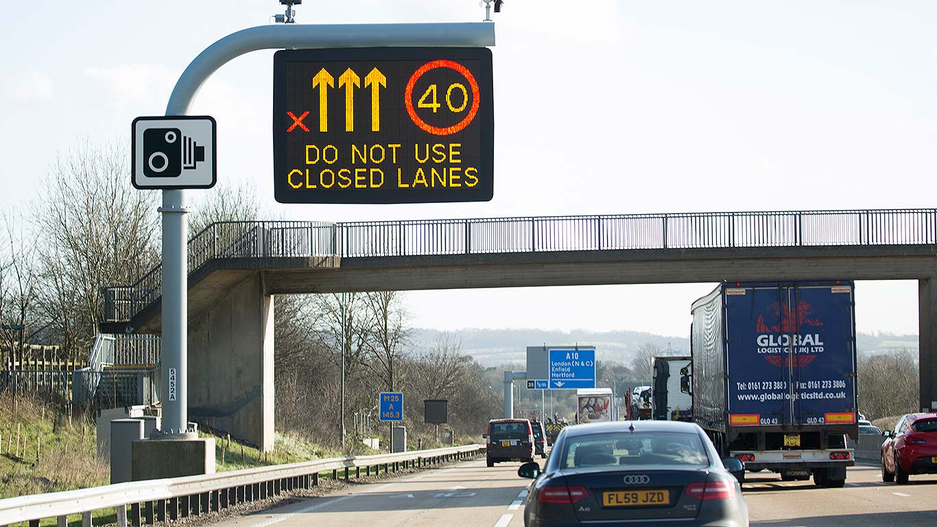
Drivers ignoring a closed lane indicated by a Red X
Accidents: fewer but deadlier
The cascading failure: unreliable stopped vehicle detection, understaffed control rooms struggle to monitor all cameras, equipment failures mean missed incidents, delays in setting Red X signs leave stranded vehicles exposed, thousands of drivers ignore Red X signs when set, and recovery operators work in live lanes whilst negotiating for basic protection. A situation Highways England says should never occur. Yet evidence and multiple inquests shows it has happened repeatedly.
The statistics tell a nuanced story. Between 2015 and 2019, 24 people died on ALR motorways, compared to 341 on conventional motorways. National Highways points to this as evidence that smart motorways are safer per mile travelled. The 2020 Stocktake found an 18% casualty rate improvement for the first nine ALR schemes following conversion.
But these figures mask a darker reality. In both 2018 and 2019, ALR fatality rates were higher than conventional motorways (0.19 vs 0.14 per hundred million vehicle miles in 2018, 0.14 vs 0.13 in 2019). More critically, live lane collisions increased from 3 per year before ALR to 19 per year afterwards, with fatal collisions rising from zero to 2.8 annually.
BBC Panorama also found that the near-misses increased 20-fold on a section of the M25 six years since hard shoulder removal. The nature of risk had fundamentally changed. The “safer per mile” argument also introduces selection bias: smart motorways are located at the busiest sections, which already had lower accident rates before conversion.
In June 2019, Jason Mercer, 44, and Alexandru Murgeanu, 22, were killed when a lorry struck their vehicles on the M1 near Sheffield. They had stopped for six minutes to exchange details after a minor collision. The Coroner stated that “a lack of hard shoulder contributed to this tragedy” and that “Smart Motorways present an ongoing risk of future deaths”.
Fifteen months earlier, Nargis Begum, 62, died after her husband’s car broke down on the M1 near Woodall Services. 153 drivers passed without reporting the stranded vehicle. A Senior Coroner found that if a driver had reported it, lane closures could have prevented her death. 16 minutes elapsed before collision, with another 6 minutes before warning signs activated.
The question isn’t whether smart motorways are statistically safer in aggregate. It’s whether we’ve created a system where the consequences of inevitable breakdowns are acceptable. On a conventional motorway, mechanical failure means pulling onto the hard shoulder. On a smart motorway, it means gambling that detection works, control rooms respond, Red X signs activate, and other drivers obey them.
Fixing the foundations

Swiss Cheese Analogy
If you’re familiar with the Swiss Cheese analogy, you can probably see how a Smart Motorway could turn into a death trap.
Each safety net can be seen as a slice of cheese, with its weaknesses represented by its holes. Accidents happen not from a single flaw but when these random holes align across multiple layers, these being the SVD, ERAs and operational functions.
So what can be done to address these issues so Smart Motorways live up to their name?
Improved SVD and emergency response
SVD is the first layer of defence and should be the most reliable system. The headline 20-second detection time was a vast improvement, but this remains contingent on system reliability, false positives, and operators verifying incidents before closing lanes.
For a safety-critical system, redundancy must be built in. Multiple sensor types (radar, CCTV, induction loops) provide cross-validation, reducing both false positives and negatives. When two independent sensors confirm a stationary vehicle, for example, radar SVD detection corroborated by MIDAS loop showing zero speed, automated Red X activation should trigger immediately. PTZ cameras automatically point to the location for operator verification, but the lane closes first, protecting the stranded vehicle within seconds rather than minutes (subject to equipment reliability).
This is straightforward sensor fusion, not complex AI (which the next section will touch upon). If radar indicates “stopped vehicle at 250m” and the loop at that position shows “zero speed for more than 5 seconds” and they agree on location, close the lane. Operators retain override capability and receive instant notification, but safety doesn’t depend on them spotting the incident first.
Proposed automated SVD verification pipeline (~30 second target)
Performance targets should mandate 99% detection within 20 seconds, targeting automated closure within ~30 seconds under normal operating conditions when cross-validated. Regular audits and public reporting ensure accountability.
When SVD systems fail or are offline for maintenance, drivers should be alerted via overhead matrices, along with a memorable location identifier and contact number. A dedicated incident reporting line should be established, with guaranteed 30-second response times. Driver awareness campaigns must emphasise that reporting stranded vehicles saves lives. It would have taken only one of the 153 drivers who passed Nargis Begum’s car to alert Highways England. The public cannot be expected to rely on systems they cannot verify are working.
Reducing individual operator workload
Technology alone cannot fix smart motorways. The people operating these systems need adequate resources and proper tools.
Staffing must scale with network expansion. Rather than ROCs managing hundreds of miles, a dedicated operator should monitor each major ALR section (20–30 miles per operator), allowing genuine attention to CCTV feeds rather than superficial scanning. Control room operators need direct communication channels with recovery services and emergency responders, with mandated 60-second response times from incident detection to lane closure.
Training should become specialised. Smart Motorway operations require different skills from general traffic management. Operators need specific training on SVD systems, automated verification pipelines, and worst-case scenario protocols. Regular simulation exercises testing response to multiple simultaneous incidents would identify systemic weaknesses before they cause fatalities.
Putting the smart in Smart Motorway
The foundational fixes (automated SVD with cross-validated lane closure, adequate staffing), ensure incidents trigger immediate responses. But these are still reactive responses. Truly intelligent systems predict and prevent.
Intelligent traffic management: from reactive to predictive
Current variable speed limits are reactive, set after congestion begins. Machine learning could make them predictive. So how does this work in practice?
The control systems problem
From a control systems perspective, traffic flow is the output we’re trying to optimise, with variable speed limits as the primary control input. Current smart motorways are essentially reactive feedback systems: speed limits react to measured congestion rather than anticipating it, introducing significant lag. By the time operators detect congestion and adjust limits, the system state has already degraded.
Semantic perception: understanding context, not just detecting events
Automated SVD cross-validation detects stopped vehicles and closes lanes rapidly. Computer vision adds semantic understanding: what type of vehicle, which lane exactly, what’s happening around it, what’s likely to happen next.
Effective semantic understanding requires systematic overhaul to CCTV infrastructure. Replacing PTZ cameras with fixed high-resolution cameras at appropriate intervals would provide continuous coverage without manual positioning and can feed directly into ML verification systems. Automated alerts should trigger when vehicles enter ERAs, removing reliance on operators spotting every incident manually.
This camera infrastructure becomes the foundation for semantic perception. Current systems detect that something is wrong, whether that’s a stranded vehicle or traffic slowing down. These detections are then fed to an operator. Modern computer vision enables the systems themselves to understand what is wrong and why.
Lane level vehicle classification identifies HGVs against cars, enabling better flow predictions near capacity, gradients, and merges, where HGV behaviour disproportionately affects shockwave formation and recovery. Queue tail detection with growth rate estimation allows operators to see congestion forming in real-time, providing rapid context. Object classification distinguishes between a stopped vehicle (immediate lane closure), debris (possible clearance delay), or a pedestrian (critical safety response).
This semantic layer transforms raw sensor data into actionable intelligence. Rather than “loop xyz shows zero speed”, operators receive “queue tail detected at J14, extending 400m northbound, growth rate 50m/min”. It’s decision-ready information, not just data.
Implementation considerations: Lightweight models (MobileNet, YOLOv8) run on roadside edge compute, providing low-latency inference with minimal infrastructure investment. PTZ cameras could operate in this system, but their single-direction coverage would be a bottleneck in semantic perception. Monitoring queue growth across four lanes simultaneously requires fixed cameras with persistent multi-lane coverage, not sequential scanning. The camera network replacement isn’t just about resolution; it’s about coverage architecture that enables genuine semantic understanding.
Sensor fusion: learning what causes congestion
Multiple sensors observing the same event create redundancy, but fusion creates intelligence. A confidence-weighted state estimator combines MIDAS loops (speed, occupancy, flow), radar SVD (stopped vehicle location), computer vision (object type, lane position, queue extent), and weather sensors (visibility, precipitation). Each source contributes with weighted confidence based on conditions. For example, vision reliability drops in fog whilst radar remains consistent.
But fusion does more than combine current observations. Machine learning models can identify precursor patterns that predict congestion before traditional metrics trigger. An HGV moving into lane 1 at a gradient, slight deceleration in lane 2 traffic, increasing headway variance. Individually unremarkable, but historically correlated with queue formation within 3-5 minutes. The system learns these patterns from observed data, refining predictions as it accumulates experience.
Learning from operator decisions: When operators intervene (setting speed limits earlier than automatic rules would trigger, or choosing not to close a lane despite marginal detection) the system logs context: traffic state, weather, time of day, operator decision, outcome. Over time, ML models learn operator expertise. Why did experienced operators set 50mph limits when flow was still acceptable? Because they recognised a pattern (Friday 4pm, wet conditions, lane closure ahead) that historically leads to rapid deterioration.
This technology shouldn’t replace operators, it should augment them. The system learns when to escalate (patterns operators historically acted on) versus when to monitor (marginal events operators typically ignore). New operators benefit from accumulated expertise without requiring years of experience. Senior operators see ML suggestions as another input alongside their judgement, maintaining override authority.
Graduated automation based on confidence:
- High confidence (>0.9, corroborated by ≥2 sources, matches historical patterns): Automatic Red X activation, operator notified
- Medium confidence (0.7-0.9, single source or conflicting data): Alert operator for verification
- Low confidence (<0.7, ambiguous sensor data): Log for investigation, no automatic action
Operators remain in control, but the system no longer depends on them to spot every incident manually or to recognise every precursor pattern from scratch.
The technology exists. National Highways already collects vast quantities of traffic data through MIDAS and SVD sensors: the sensor network is deployed. What’s missing is the analytical infrastructure to process this data predictively rather than reactively. Model Predictive Control (MPC) algorithms, already proven in industrial automation, could be adapted for motorway traffic management. Similar systems have demonstrated significant results: in Amsterdam, variable speed limit systems reduced overall accident rates by 23%, whilst on Germany’s A5 autobahn, accident rates fell by 20% in areas using variable speed limits and lane control.
Weather integration would enhance this further. Rain detected upstream becomes a disturbance input, triggering gradual speed limit reductions before drivers reach wet conditions. Forecast fog automatically lowers limits before visibility degrades. These aren’t hypothetical scenarios: the Netherlands uses visibility sensors to drop limits to 80km/h or 60km/h when fog is detected. Germany’s motorway control systems adjust limits based on time, weather, and traffic conditions across 9% of their autobahn network. The difference between reactive and predictive control is the difference between treating symptoms and preventing problems. In traffic management, that difference saves lives.
Smart Motorways with smart connections
Integrating variable speed limits with navigation apps
Most consumer navigation apps do not reliably show the current mandatory variable limit from gantries in real time. Moreover, they also cannot provide accurate estimates without this data. The fix is straightforward: connect existing systems.
National Highways already publishes variable speed limit data through its NTIS, which pushes updates to subscribers within one minute of collection. National Highways operates developer APIs for road closures and digital signage. Extending this to include current variable speed limits would allow navigation apps to calculate journey times using actual conditions rather than theoretical maximums. Apps already have the capability to display speed limits and provide alerts; they just need real-time data.
Furthermore, the ML traffic prediction system proposed earlier could feed its forecasts into the same API. Navigation apps would then account for both current variable limits and predicted congestion, giving users genuinely accurate journey planning. A connected system is a smarter system. The infrastructure exists on both ends; it just needs integration.
Connected vehicles: from passive displays to active participants
Smart motorways currently treat vehicles as passive objects to be managed. Connected vehicle technology allows them to become active participants in traffic flow, reducing reaction time, ambiguity, and non-compliance.
V2I: Real-time hazard awareness
Vehicle-to-Infrastructure (V2I) communication delivers safety-critical information directly to in-vehicle displays before drivers reach overhead gantries. Variable speed limits appear with context (“40 mph for 2 miles: incident ahead”) rather than unexplained numbers. Hazard warnings arrive before visual range: “stopped vehicle in lane 1, 800m ahead”. Emergency vehicles receive priority alerts: “lane 2 closing in 500m, merge left”.
V2I augments, rather than replaces, gantry signalling: roadside signs remain the legal authority, while equipped vehicles gain earlier, clearer guidance.
This capability is already standardised under the EU’s Cooperative Intelligent Transport Systems (C-ITS) framework, which defines message types for hazards, speed limits, and lane management. Unlike navigation alerts, C-ITS messages are safety-classified, prioritised, and rate-limited, similar to aviation and rail alerting hierarchies. Research on similar in-vehicle speed systems demonstrates that providing contextual explanations alongside speed limits improves driver compliance compared to displaying numbers alone.
This mirrors how European Train Control System (ETCS) transformed rail safety: signals moved from trackside into the cab, reducing reaction time and misinterpretation. Motorways remain one of the few safety-critical transport systems still relying primarily on external signage.
Cooperative merging and emergency response
At reduced ERA spacing (≈1.5km), cooperation becomes critical. Connected vehicles receiving “ERA ahead, prepare to give way: lane 1” can create space automatically. Emergency vehicles broadcast their approach, enabling dynamic corridor formation without relying solely on manual Red X deployment.
The technical stack already exists: 5G connectivity, NTIS data feeds, and in-vehicle displays. The remaining challenge is standardisation and coordination, not new roadside infrastructure.
Privacy and implementation constraints
Connected vehicle systems must be privacy-preserving by design. Infrastructure broadcasts information; vehicles receive it passively. Location data is not transmitted unless a driver explicitly requests assistance.
Processing occurs at the roadside edge, not in centralised databases. Only aggregated, anonymised flow data feeds prediction models. This architecture enables the safety benefits of connectivity without creating a surveillance system.
Smart, or just cheap?
The M42 pilot proved smart motorways can work.
The national rollout proved we didn’t run them as safety-critical systems. Detection arrived late. Refuges were spaced for cost. Control rooms didn’t scale. Enforcement lagged. Equipment failed. The holes aligned and people died.
The fix is not mysterious: automate lane closure when sensors agree, resource operations properly, and treat integration as infrastructure. Then build real intelligence on top: semantic perception, predictive control, and connected-vehicle warnings.
If we won’t commit to that standard, we should restore hard shoulders. Because half-measures aren’t a middle ground – they’re a gamble that has already cost lives.
This is the first post in a series examining how infrastructure shapes opportunity, productivity, and quality of life across Britain. Next: East West Rail and the economic case for regional connectivity, followed by Universal Studios Great Britain and the transport infrastructure required to serve 8.5–12 million annual visitors.
Last updated 03/01/26: Added Infrastructure stack and expanded solutions sections (diagrams to be added).